Adopting a joint mechanism for groundwater management in Algeria, Tunisia and Libya Economy

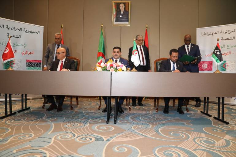
Algeria – The outcomes of the tripartite summit of the leaders of Algeria, Tunisia, and Libya entered into force within 48 hours of its first meeting in Tunis, last Monday, as the three countries signed the first agreement to establish a “consultation mechanism on joint groundwater management in the Northern Sahara,” with its headquarters in Algeria.


The Algerian Minister of Irrigation, Taha Darbal, said during the signing ceremony, last Wednesday evening in Algiers, that the agreement “opens a promising new page in the field of coordination and cooperation between our countries in a vital field, which is water resources, to which every development process is linked.”
Derbal also pointed out that the document would “deepen the signatory countries’ knowledge of their shared water resources in the northern Sahara and intensify the exchange of information in the same context,” according to what was reported by the Algerian News Agency.
The Algerian minister considered that “allocating a fixed and permanent headquarters for the mechanism allows the three countries to work comfortably, and within a clearly defined and codified framework, in a way that consolidates each country’s sovereignty over its water resources,” as the source adds.
In turn, the Tunisian Minister of Agriculture, Water Resources and Fisheries, Abdel Moneim Belaati, confirmed that “the presidential summit meeting provides great political cover for the passage and maximum speed towards field implementation.”
For his part, the Deputy Minister of Water Resources of the State of Libya, Muhammad Faraj Qanidi, stressed that the agreement “lays the foundation for constructive cooperation to serve the peoples of the region, and to ensure the management, development and sustainability of these shared resources for future generations.”
The largest groundwater level in the world
In this regard, Ibrahim Mouhoush, an international expert in water and food security, said that Algeria, Tunisia, and Libya share one of the largest groundwater levels in the world, through the Alpine layer, which extends between southeastern Algeria, western Libya, and southern Tunisia, over an area equivalent to twice the size of France. almost.
Mawwash explained that it is the largest aquifer in the world, as its size is actually estimated at about 40,000 to 50,000 billion cubic meters of ground level.
The expert confirmed in a statement to Al Jazeera Net that the common class is distributed among the three countries, with 70% in the Algerian territory in the south-east of the country, 20% under Libya, and 10% across the Tunisian region.
Improving water management and activating consultation
Regarding the importance of the announced agreement, Mouhouche, a professor at the National Higher School of Agriculture in Algeria, explained that the countries concerned are located in the heart of the geographical region of the Middle East and North Africa, known for drought and severe water shortages. Moreover, almost all of its lands are arid and desert.
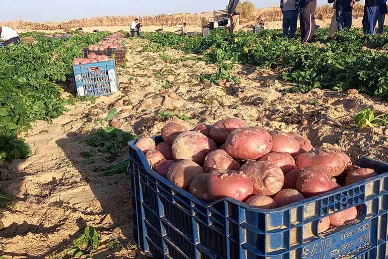
This situation means, according to the speaker, that renewable water resources cannot cover the water needs of these countries, especially with regard to the agricultural sector, which consumes between 70 and 85% of its water potential, although it can reach and exceed 85% in countries rich in water resources. .
Accordingly, the three countries are classified within the category of countries that are very poor in water resources, in relation to the scarcity threshold set by the World Bank at one thousand cubic meters per capita per year, according to the same expert.
As a result, agricultural production for a long time could not cover the nutritional needs of the population in some products, especially cereals and their derivatives, as well as strategic agricultural industry inputs.
To achieve this goal, one of the best modifications required is to provide maximum benefit to economic and agricultural activities that require a lot of water, such as grains and industrial crops, by transporting it to areas of the Great South that are filled with groundwater coming from the Alpine layer.
In this context, expert Mawhoush included the agreement signed by the three countries, which stipulates studying means of improving the management of groundwater resources, and reactivating the consultation mechanism regarding them, which “was initiated by Algeria, Tunisia, and Libya since 2005, as part of the Sahara and Sahel Observatory project.”
Risks of unregulated exploitation
For his part, international expert in groundwater, Jamal Maize, revealed that the aquifer system in the northern Sahara, which is shared by Algeria, Tunisia, and Libya, covers an area of more than one million square kilometers.
In contrast, the amount of rain falling in the aforementioned regions does not exceed 100 millimetres, while groundwater reserves are not renewed, as they are fossil geological reserves, and therefore intensifying their exploitation leads to the emergence of a number of problems, as Maezi says.
The water expert highlighted in an interview with Al Jazeera Net that the decline and unregulated exploitation portends danger in the water level, the increase in the price of pumping, the weakness of artesian water, the drying up of natural outlets, and the increasing risk of deterioration of the chemical quality of the water due to the high percentage of salinity.
There are other risks that could affect the quantity and quality of groundwater, due to deficiencies in sewage and wastewater management, as well as in oil and gas exploration, he said.
According to the spokesman, this is what requires the three countries to control the amount of water extracted to ensure the future of the region, especially through a joint policy to preserve water resources, through data exchange.
Maezi, a professor of hydrology at Houari Boumediene University of Science and Technology, said that creating a joint database aims to enhance the value of information, to be a tool for exchange, and to create a new model that simulates the hydrodynamic behavior of the aquifer system and to enable joint management of groundwater.
Expert Mu'izzi revealed that the simulations conducted on the mathematical model highlighted the areas most at risk, as they “enabled the development of a risk map across the three countries concerned, to find a form of joint management of the basin.”
Source: Al Jazeera


